NavIC
The following signals are supported:
High-end GNSS RF simulator Replicator:
L5, S-band
Mid-level GNSS RF simulator Simceiver :
L5, S-band
L5, S-band
GNSS software receiver ARAMIS :
L5, S-band
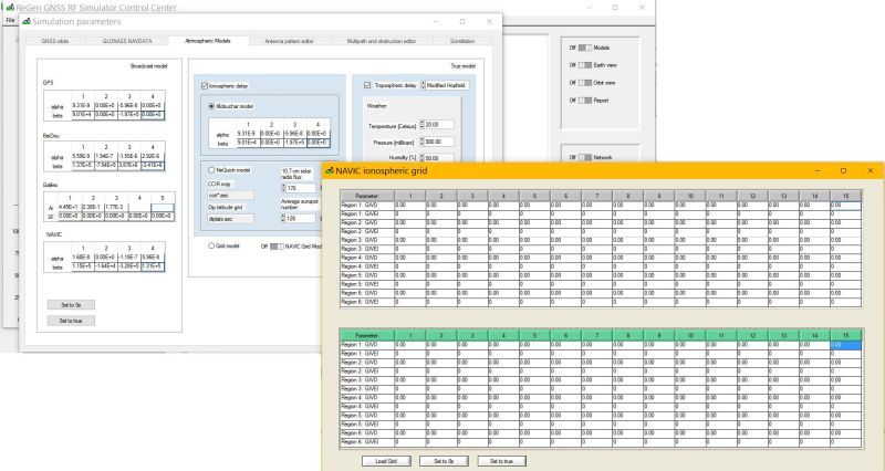
Ionospheric models include NAVIC grid model
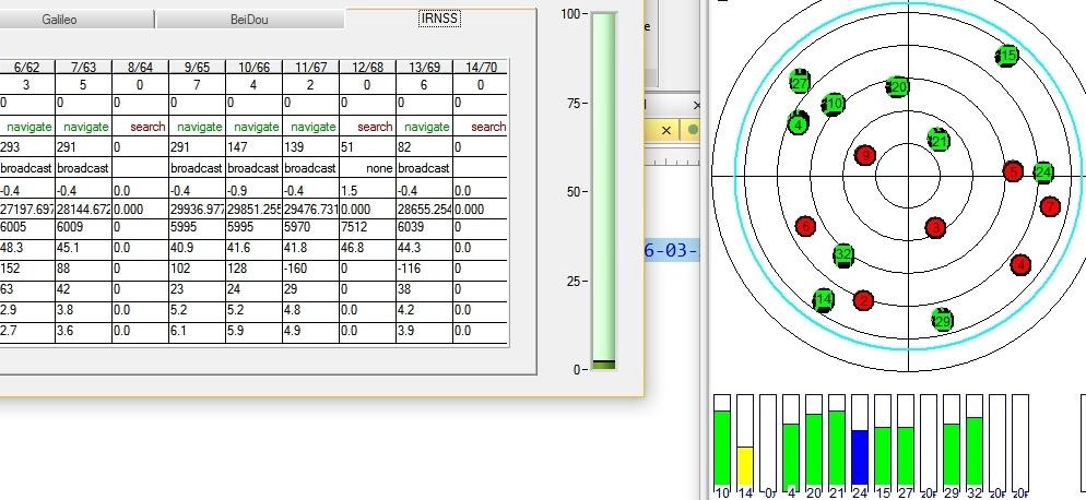
GNSS SDR receivers (ARAMIS and ISM) support L5 and S-band NAVIC signals.
User can immediately apply his/her own algorithms to the navigation solution calculation, including ionospheric error calculation from broadcast data.
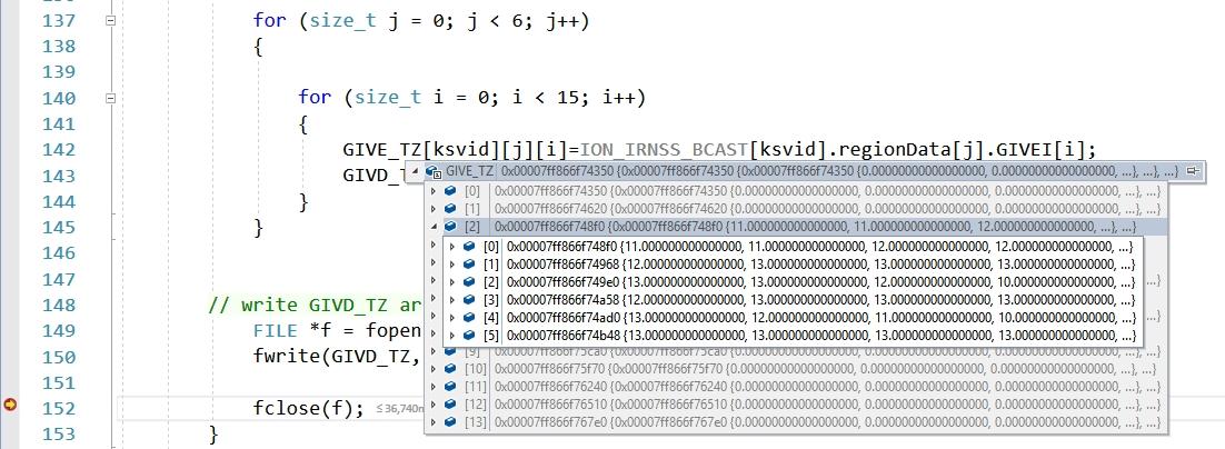
API allows user to access NAVIC NAVDATA and apply user defined algorithms to the grid data.